
Walk a Burbank Street Record
Start with one exact Burbank address, not a person’s name. Address-first work avoids false matches and reveals the identifiers used by Cook County. The strongest chain moves from a physical location to a 14-digit Property Index Number, or PIN, and then into tax, deed, map, and city records. Each source answers a different question. The assessor describes a parcel, the Clerk indexes recorded transfers, and Burbank keeps defined municipal files.
- Normalize the house number, direction, street name, unit, city, and ZIP. Keep the original form too.
- Use the Cook County Assessor address search to identify the PIN.
- Open that PIN in CookViewer and confirm the parcel outline.
- Search the Cook County Clerk recordings index from 1985 forward.
- Ask Burbank for defined permit or code files, then use a dated reverse directory for historical household clues.
This street-by-street process creates an evidence trail without turning one record into a claim it cannot support. Label each name as owner, taxpayer, applicant, grantee, subscriber, or voter making a self-match.
Burbank Street Directory Search Fields
The Assessor form expects a street name without a suffix such as Avenue or Street. Its basic mode requires a house number, street name, city, and CAPTCHA; direction and unit are optional. Advanced search can scan a range of house numbers, useful for a named Burbank street. Applicant, appeal, township, year, class, and partial-PIN controls serve other property questions and do not create a household directory.
| Route | Fields | Use |
|---|---|---|
| Address | House number, direction, unit, street, city | Find one situs parcel |
| Advanced range | Start/end number, street, city, township, class | Review parcels by street |
| PIN | 14-digit identifier | Open a parcel card |
| Neighborhood | Township, neighborhood, class | Compare assessment groups |
A parcel detail may show location, township, class, land and building size, neighborhood, tax code, valuation, age, exemptions, appeals, and images. The Assessor warns that property location is not a legal or postal mailing address. Capture the retrieval date.
The advanced address form shows the official range controls.
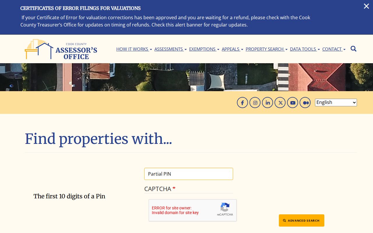
The form confirms that a Burbank street directory range belongs in the property index, not an inferred resident list.
Three Burbank Address Clues
A parcel can hold three distinct address clues. The situs address is the physical site. The tax mailing address is where notices go. The legal description identifies land through a subdivision, lot, and block. A mailing address may point to the site, another city, a trustee, or an agent, and Cook metadata says owner and mailing data are updated intermittently. It may lag.
The Cook County Property Tax Portal accepts a PIN or house number, street, optional unit, city, and ZIP. It can return location, township, municipality, class, assessed value, building and lot size, mailing address, billed history, exemptions, and a deed or lien summary. Obtain the actual recorded document when legal terms matter.
The official portal provides a second Burbank address view.
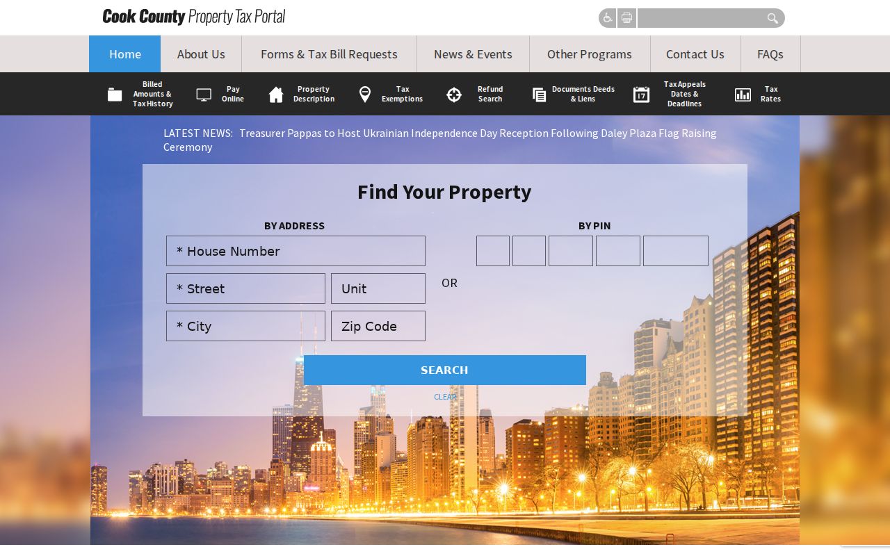
Its fields compare parcel and postal data, but still describe property rather than every resident.
Note: A matching tax mailing address supports an owner-occupancy theory, but never proves who was in the home on a given date.
Map Burbank Streets in CookViewer
CookViewer accepts parcel or address text and 10-digit, 14-digit, or dashed PIN forms. Search hits may be near an address point rather than exact, so compare the outline with the assessor card. Parcel detail adds municipality, township, zoning, tax context, buildings, imagery, district resources, and a historical archive described as 2000 to current. Export, print, report, imagery, and comparison controls preserve context.
For a block view, click each adjoining parcel and record its PIN. The Nearby tool allows a radius up to one mile plus filters for building or land area, construction type, age, and units. Those filters compare parcels, not occupants. Cook GIS also separates Address Points from ZIP Code Boundaries, so postal areas can be checked without confusing them with city limits.
- Parcel
- A mapped unit of land used for assessment.
- Situs address
- The physical location, which can differ from the tax mailing address.
- Plat
- A recorded map of subdivision lots, blocks, streets, and easements.
- Criss-cross directory
- A dated volume arranged by street or phone instead of only by surname.
Records Along Burbank Streets
No single Burbank street directory joins every address record. Build the chain one custodian at a time and preserve the role attached to each name. An owner may live elsewhere. A permit applicant may be a contractor. A directory entry may be a subscriber, boarder, business, or past resident.
| Record | Keeper | What it shows | Access |
|---|---|---|---|
| Assessment and tax | Cook County | PIN, situs, taxpayer, mailing, parcel facts | Web portals; office correction |
| GIS map | Cook GIS | Shape, districts, zoning, imagery | CookViewer and ArcGIS |
| Deeds and liens | Cook County Clerk | Parties, instrument, date, legal description | Online from 1985; tract books earlier |
| Permits and code | Burbank | Defined work, inspection, zoning action | Department or narrow FOIA |
| Historical listings | Regional libraries | Dated subscriber, household, or business | Database, microfilm, reference help |
| Voter registration | Illinois and Cook | A person’s own match and election geography | Self-lookup; controlled list rules |
If a portal fails, use the counter or request channel. Clerk Recordings is at 118 N. Clark Street, Room 120, Chicago, and its help desk is 312-603-5050. Older deeds require subdivision or legal-description work because online access begins in 1985.
Follow Burbank Deeds by PIN
A street name is not the safest key for land history. Convert every Burbank address to its PIN, then search the Clerk index by PIN and by grantor or grantee. A grantor transfers an interest; a grantee receives it. Save the document type, date, instrument number, parties, and legal-description match. A deed proves a conveyance, not a complete household.
Pre-1985 work moves to subdivision tract books downtown. Plats bridge a current location to lot and block when a number or place label changed. The former Recorder of Deeds is another trap: the Clerk assumed recorder duties on December 7, 2020. Current requests belong with the Clerk even when an old citation names the former office.
Fees and copy methods change. Confirm current costs. An index lead may identify the instrument, while a full or certified image is needed when exact transfer terms matter.
Burbank Permits Need a Request
The Burbank Building Department publishes forms for construction, demolition, garages, driveways, fences, HVAC, plumbing, electrical work, signs, pools, remodeling, and related work. It also handles maintenance, enforcement, variances, special uses, subdivisions, and zoning. Its public page has no verified historical permit index by address.
Give the department the exact address, record type, and dates, or submit a narrow Illinois Freedom of Information Act request. The city form supports email, mail, fax, or in-person submission. Illinois FOIA generally allows five business days for a noncommercial response, with a possible five-day extension.
The official building page shows the current permit route.
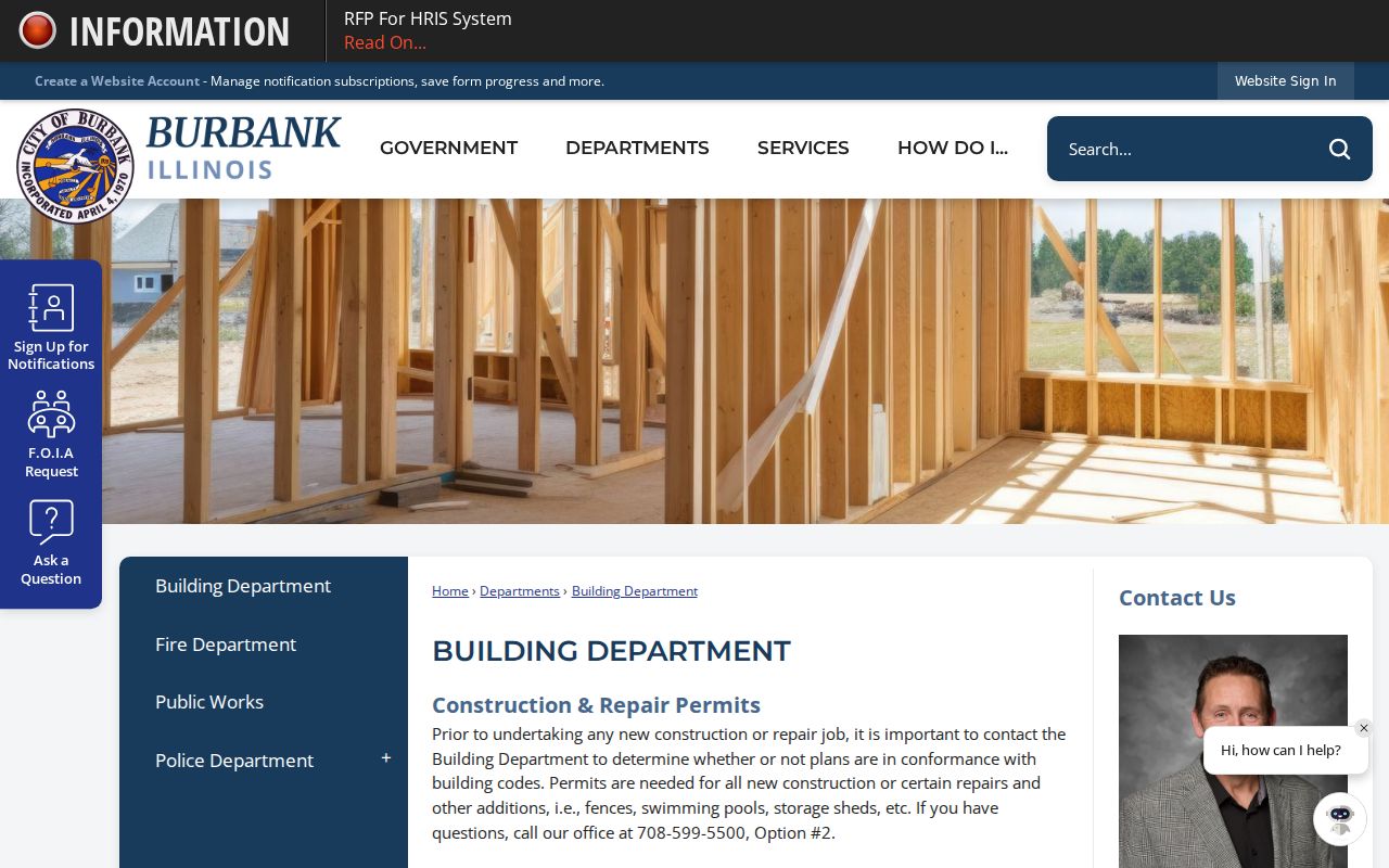
The page confirms the department’s role and why a focused request is needed for an old address.
Burbank Streets and Voter Limits
The Illinois voter self-lookup asks for first name, last name, date of birth, and ZIP. It lets a voter confirm an individual registration, not browse everyone along a Burbank street. Cook County does not publish a general block roster. Controlled voter files carry qualifications and restrictions.
Ward, precinct, township, district, and ZIP are separate geographies. They describe where a parcel sits without naming residents. A failed match can reflect input, a move, protected data, or status. It does not prove absence.
Burbank Streets Before Incorporation
Burbank incorporated on April 4, 1970, after a record trail through Lyons Township, South Stickney, Stickney Township, county files, subdivisions, and regional postal labels. City history describes farms, a State Road plan, 1920s subdivision growth, a 1950s utility build-out, and near-complete subdivision by 1979. The era determines the office.
For a pre-1970 address, keep the subdivision, township, cross street, original spelling, and year. County land and tax books may matter more than city files. Regional reverse directories then add a dated clue. Their holdings are covered in the Burbank city directory collections.
Burbank has no verified citywide renumbering table. Chicago’s 1909 conversion must not be projected here. One documented local issue is postal: a 2009 USPS bulletin shifted one delivery from 60455 to the Burbank 60459 last line. That was not an annexation or title change.
Burbank Street Directory Boundaries
Property rolls omit many renters and household members. Utility accounts, delivery records, school enrollment, and motor-vehicle addresses are not public substitutes. Address confidentiality can hide or replace a location. Illinois’s program can use substitute addresses in new government records, though property confidentiality cannot always be ensured.
A street directory result should use narrow labels: owner on a parcel card, grantee in a deed, subscriber in a dated volume, or permit tied to an address. Avoid “lives here” unless a current, suitable source establishes it.
Lawful use. Use Burbank address records for family history, property research, consumer safety, or civic work. Never use them to stalk, harass, intimidate, or expose a protected person.
When a lawful trail reaches private household data, stop and mark the limit. That protects people and produces a more accurate record.